-
Home
- About +
- Council (Board) +
- Committees +
- News +
-
Calendar
- Resources +
-
Contact
- Login
Boundary Map
Use this interactive map to see which Sherman Oaks Neighborhood Council Area you live in, and which Council members represent your area. Find the street where you live or work in the highlighted map areas, and click your mouse. Follow the links. Neighborhood Council boundaries may differ from US Postal Service and Los Angeles City Council district boundaries such that an address with a "Sherman Oaks" city designation may actually not fall within the jurisdiction of the Sherman Oaks Neighborhood Council.
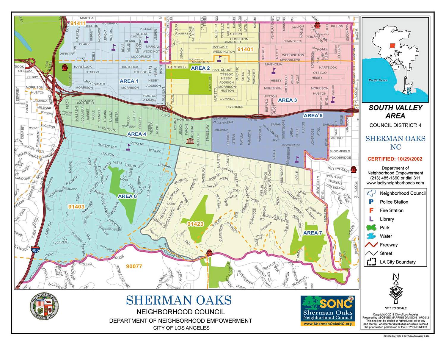
Boundary Descriptions
The boundaries of the community represented by the Sherman Oaks Neighborhood Council are as follows:
A. Burbank Boulevard on the north - The northern boundary shall be Burbank Boulevard except for the commercial corridor on Van Nuys Boulevard between Burbank Boulevard and Magnolia Boulevard.
B. Coldwater Canyon Avenue on the east - The boundary on the east follows Coldwater Canyon south from Burbank Boulevard (Coldwater Canyon Avenue south to Kling Street, west to Van Nord Avenue and does not include properties in the 91604 zip code), south to Sarah Street west to the Avenue south to Valleyheart Drive west to Fulton Avenue south to Ventura BL east to Longridge Avenue south to the southern terminus of Longridge Avenue, and then a sight line from the southern terminus of Longridge Avenue to the intersection of Split Rock Road and Mulholland Drive.
C. Mulholland Drive on the south
D. The 405 Freeway on the west
Areas with "Sherman Oaks" Postal designations not within SONC Boundaries:
West of 405 freeway & east of Sepulveda Blvd or Firmament Ave: Encino Neighborhood Council.
North of Burbank Blvd & south of Oxnard St: Van Nuys Neighborhood Council.

JOIN OUR MAILING LIST

Neighborhood Council Calendar
Upcoming Meetings & Events
- Jul14 Council Meeting
- Jul17 Planning and Land Use (PLUM)
- Jul22 Government Affairs Committee Meeting
- Jul23 Finance Committee Meeting
- Jul30 Finance Committee Meeting
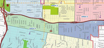
Area Boundaries and Map
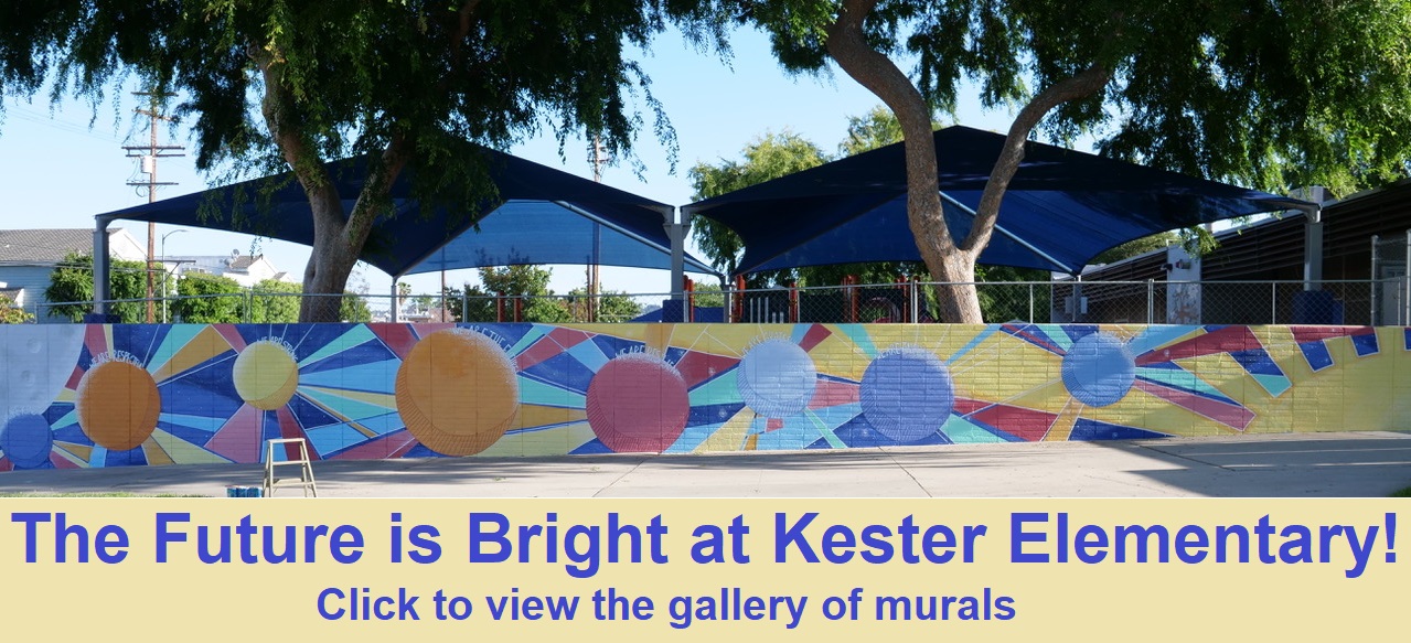
SONC Education Committee Kester Elementary School Murals Project
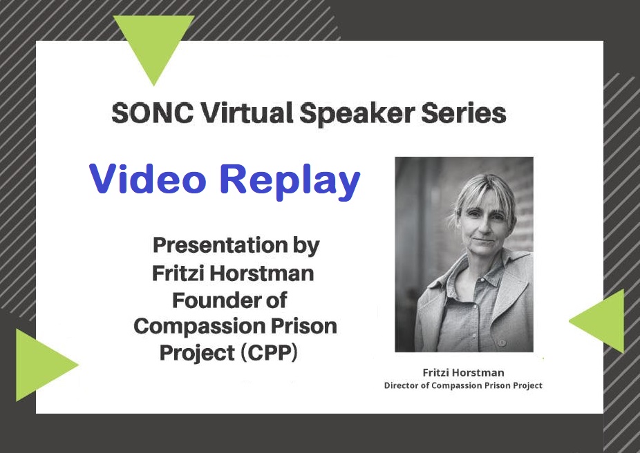
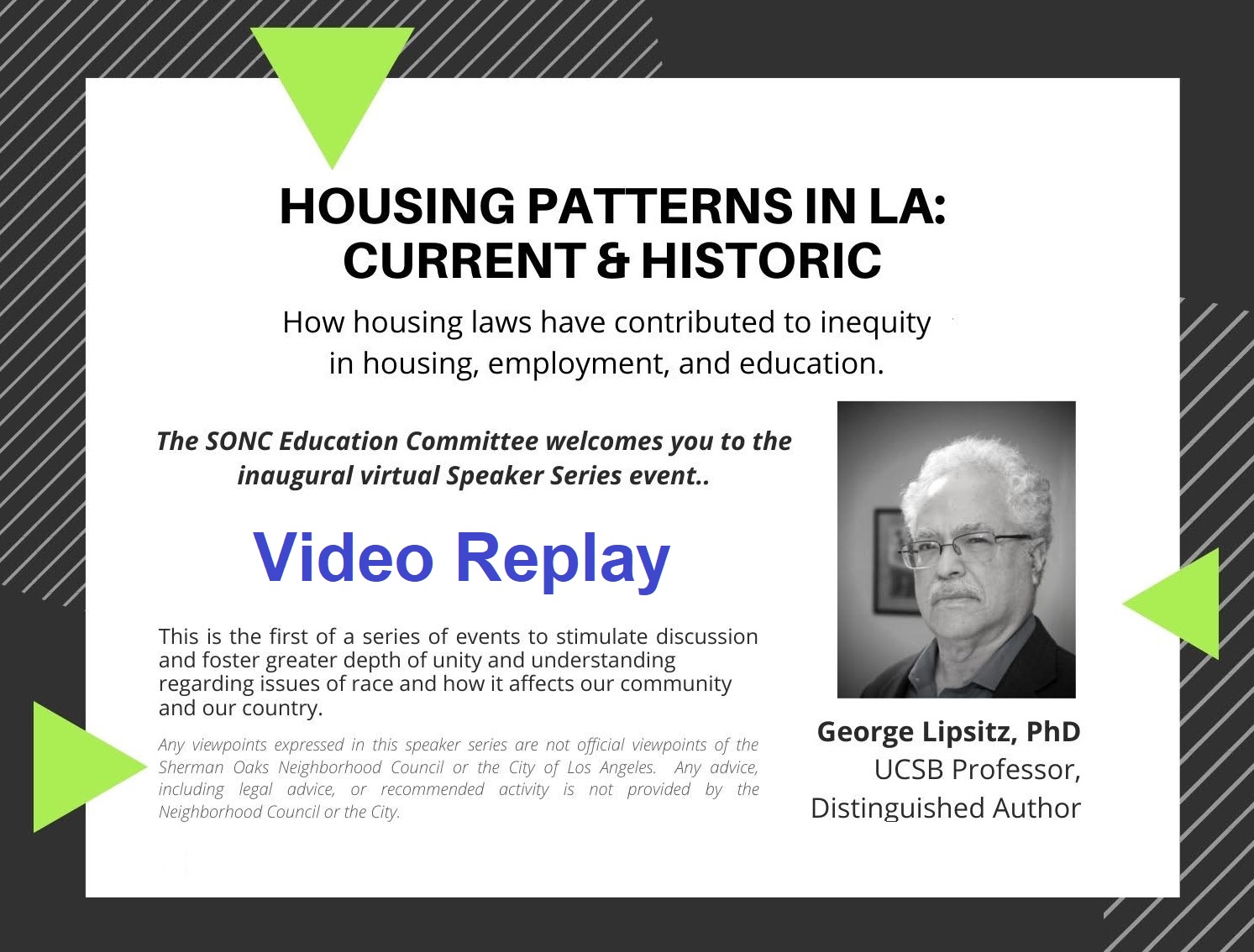
Video Replay - SONC Speaker Series
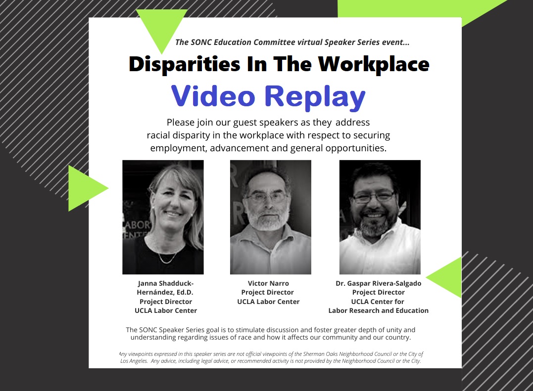
Video Replay - SONC Speaker Series

Video Replay - SONC Speaker Series